Today, we made the last segment of Route 66, from San Bernardino, which is about 80 miles inland, to Santa Monica on the cost. In the 1930's this was mostly farmland, with roads laid out in straight lines wherever geography permitted. But now it is prime Southern California real estate, and is one continuous suburb. It took about 4 hours to drive the last 80 miles. You have to pay attention to signs to figure out when you have passed from one town into another.
 |
| Yes Virginia, there really is a Rancho Cucamunga. |
 |
| The 60's were a wonderfully simple time for branding... |
There were lots of vintage signage along the way:
 |
| A view downhill along Foothills drive. Note the smog! |
 |
| The palms are all curved towards the south. |
Route 66 manages to pass a fair number of cultural icons in its last few miles:
 |
| Views of the famous Hollywood sign appears from time to time |
 |
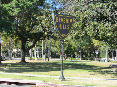
| It goes through Beverly Hills. |
 |
| It crosses Rodeo Drive. |
The "official" end of Route 66 is the rather unsatisfying intersection of Lincoln Avenue at Olympic. But popular consensus extends it about a mile and a half to Ocean Drive and the cliffside Palisades Park.
 |
| No marker here. Just several closed business properties awaiting redevelopment. |
 |
| Elfrida at Lincoln & Olympic. |
 |
| Another "official" end of the highway, in the grass of Palisades park, which unfortunately has become popular with the homeless. |
 |
| And a few feet away, another more photogenic official end marker, addressing the needs of the camera-laden. |
 |
| The Santa Monica Pier is a nearby. |


No comments:
Post a Comment